Explore Moveka

Matatu route

126

KiserianRailways

About 28 km between Kiserian and Railways, through Nkaimurunya, Karen, Mugumo-ini, Nairobi West. 9 Moveka Stations are on or beside the line.

KiserianRailways2 km © OpenStreetMap contributors

The route at a glance

28 km through 7 sections, drawn to scale. Select a section to jump to its stops.

Route 126 at a glanceOverview of route 126 from Kiserian to Railways: 28 km through 7 sections, with 68 stages, 3 change points and Moveka Stations beside 9 stages. The ordered list below gives the same information in text.Olkeri, 0.0 to 5.8 km, 18 stagesOlkeriNkaimurunya, 6.4 to 10.9 km, 21 stagesNkaimurunyaKaren, 12.0 to 16.6 km, 11 stagesKarenMugumo-ini, 17.1 to 22.7 km, 12 stagesMugumo-iniNairobi West, 23.6 to 24.8 km, 3 stagesNairobi WestWoodley/Kenyatta/Golf Course, 25.8 to 25.8 km, 1 stageWoodley/Kenyatta/G…Starehe, 26.8 to 27.8 km, 2 stagesStarehe22Kiserian · 0 kmRailways · 28 km
Route 126 at a glanceOverview of route 126 from Kiserian to Railways: 28 km through 7 sections, with 68 stages, 3 change points and Moveka Stations beside 9 stages. The ordered list below gives the same information in text.Olkeri, 0.0 to 5.8 km, 18 stagesOlkeriNkaimurunya, 6.4 to 10.9 km, 21 stagesNkaimurunyaKaren, 12.0 to 16.6 km, 11 stagesKarenMugumo-ini, 17.1 to 22.7 km, 12 stagesMugumo-iniNairobi West, 23.6 to 24.8 km, 3 stagesNairobi WestWoodley/Kenyatta/Golf Course, 25.8 to 25.8 km, 1 stageStarehe, 26.8 to 27.8 km, 2 stages33Kiserian · 0 kmRailways · 28 km

Stops from Kiserian to Railways

Show Railways to Kiserian
  1. Start
    Kiserian
    0.0 km
  2. Olkeri

    0.0 km–5.8 km · 18 stages

    Nearest served area: Kiserian

  3. Show the 18 stagesKiserian, Triangle, Gichagi and 15 more
    • Kiserian0.0 km
    • Triangle0.7 km
    • Gichagi1.0 km
    • Kwa Maji1.3 km
    • Kahungo1.7 km
    • Horse Man1.9 km
    • Nyati2.1 km
    • Nalepo2.3 km
    • Kwa Ratio2.4 km
    • Mashuria2.6 km
    • Rimpa Road2.9 km
    • Kwa Njenga3.3 km
    • Kamura3.9 km
    • Kanisani4.3 km
    • Flats/Arap Moi4.6 km
    • White House4.8 km
    • Barabara Mpya/Adventist University5.4 km
    • Acacia5.8 km
  4. Moveka Station

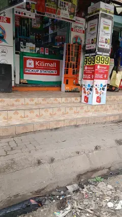
    Xtreme media Kiserian

    28 m from the route · send or collect parcels here

    1.0 km
  5. Nkaimurunya

    6.4 km–10.9 km · 21 stages

    Nearest served area: Rongai

  6. Show the 21 stagesMagacia, Exciting, Kwa Kimani/Laiser Hill and 18 more
    • Magacia6.4 km
    • Exciting6.6 km
    • Kwa Kimani/Laiser Hill6.9 km
    • Baptist Church7.1 km
    • Caltex/Total7.3 km
    • Millenium7.5 km
    • Places/Chap Chap7.7 km
    • Olerai8.0 km
    • Nairobi Women's Hospital8.2 km
    • Fair Mart8.4 km
    • Kware8.6 km
    • Tuskys9.1 km
    • Kenol9.3 km
    • Nyotu9.4 km
    • Naston9.6 km
    • Barclays9.7 km
    • Sironik Road9.9 km
    • Kobil10.1 km
    • Tumaini/Ongata Rongai10.2 km
    • Maasai Mall10.3 km
    • Maasai Lodge10.9 km
  7. Moveka Station

    Xtreme media Gataka

    203 m from the route · send or collect parcels here

    8.6 km
  8. Moveka Station

    Xtreme media Tuskys

    39 m from the route · send or collect parcels here

    9.1 km
  9. Moveka Station

    5th Avenue extreme media

    70 m from the route · send or collect parcels here

    9.3 km
  10. Moveka Station

    Xtreme media kobil

    47 m from the route · send or collect parcels here

    10.1 km
  11. Moveka Station

    Xtreme media Tumaini

    62 m from the route · send or collect parcels here

    10.2 km
  12. Moveka Station

    Xtreme media Masai lodge

    27 m from the route · send or collect parcels here

    10.9 km
  13. Karen

    12.0 km–16.6 km · 11 stages

    Nearest served area: Rongai Masai lodge

  14. Show the 11 stagesMultimedia University, Mukoma Road, Sembe Road/Kisembe and 8 more
    • Multimedia University12.0 km
    • Mukoma Road13.3 km
    • Sembe Road/Kisembe13.6 km
    • Banda School13.9 km
    • Cambridge14.2 km
    • Avocado14.7 km
    • Swara14.8 km
    • Park Place15.2 km
    • CUEA/Bogani Road15.6 km
    • Consolata16.3 km
    • Bomas/Galleria16.6 km
  15. Mugumo-ini

    17.1 km–22.7 km · 12 stages

    Nearest served area: Langata

  16. Show the 12 stagesBomas, Wildlife Clubs of Kenya, Langata Cemetary and 9 more
    • Bomas17.1 km
    • Wildlife Clubs of Kenya17.7 km
    • Langata Cemetary18.5 km
    • Langata Barracks19.1 km
    • Langata Hospital/Mobil19.7 km
    • HQ20.8 km
    • Deliverance Church Langata/Kanisani21.0 km
    • Carnivore/Rafikiz21.4 km
    • Dam Estate21.6 km
    • Sunshine Sec. School22.3 km
    • AMREF22.5 km
    • Langata Road Primary School22.7 km
  17. Moveka Station

    Mayacare Pharmacy

    284 m from the route · send or collect parcels here

    21.4 km
  18. Nairobi West

    23.6 km–24.8 km · 3 stages

    Nearest served area: Nairobi West

  19. Blue Sky/T-Mall

    23.6 km

    Change here for 14B151624

    and 2 more33SB125

  20. Madaraka Flyover

    24.1 km

    Change here for 14B151624

    and 2 more33SB125

  21. Nyayo Stadium

    24.8 km

    Change here for 14A14B1516

    and 1 more125

  22. Moveka Station

    Samken Electronics

    332 m from the route · send or collect parcels here

    24.8 km
  23. Woodley/Kenyatta/Golf Course

    25.8 km · 1 stage

    Nearest served area: Nairobi West

  24. Makaburini

    25.8 km

    Change here for 12C14A14B15

    and 8 more33B33C33FED33IMR33MKR33UTW110110ATH

  25. Starehe

    26.8 km–27.8 km · 2 stages

    Nearest served area: Kamakis

  26. Agip

    26.8 km

    Change here for 2348

    and 8 more12D14A14B15162433B33C

  27. Railways

    27.8 km

    Change here for 2348

    and 4 more56102111125

  28. End
    Railways
    27.8 km

Ready to send?

Parcels travel route 126 too. Send from a Station on the line.

Send a package

Stops from Approved SACCOs - University of Nairobi C4D Lab reporting/sharing, service 2019 to 2020. Map data © OpenStreetMap contributors.