Matatu routes / Route 34L
The route at a glance
10 km through 4 sections, drawn to scale. Select a section to jump to its stops.
Route 34L at a glance Overview of route 34L from OiLibya to Kenyatta National Hospital: 10 km through 4 sections, with 19 stages, 1 change point and Moveka Stations beside 1 stages. The ordered list below gives the same information in text. Mugumo-ini, 0.0 to 7.3 km, 13 stages Mugumo-ini Nyayo Highrise, 7.8 to 7.8 km, 1 stage Nyayo Highrise Woodley/Kenyatta/Golf Course, 8.3 to 9.5 km, 4 stages Woodley/Kenyatta/G… Kilimani, 10.1 to 10.1 km, 1 stage Kilimani OiLibya · 0 kmKenyatta National Hospital · 10 kmRoute 34L at a glance Overview of route 34L from OiLibya to Kenyatta National Hospital: 10 km through 4 sections, with 19 stages, 1 change point and Moveka Stations beside 1 stages. The ordered list below gives the same information in text. Mugumo-ini, 0.0 to 7.3 km, 13 stages Mugumo-ini Nyayo Highrise, 7.8 to 7.8 km, 1 stage Nyayo Highri… Woodley/Kenyatta/Golf Course, 8.3 to 9.5 km, 4 stages Kilimani, 10.1 to 10.1 km, 1 stage Kilimani OiLibya · 0 kmKenyatta Nationa… · 10 km
Start OiLibya 0.0 km
0.0 km–7.3 km · 13 stages
Nearest served area: Langata
Show the 13 stagesOiLibya, Rubia, Mugomuini Market and 10 more OiLibya 0.0 km Rubia 0.1 km Mugomuini Market 1.2 km Maboko Road 1.9 km PCEA Junction 2.1 km HQ 4.4 km Deliverance Church Langata/Kanisani 4.6 km Carnivore/Rafikiz 4.9 km Dam Estate 5.1 km Langata Road Primary School 6.3 km Weston 6.5 km Bluesky Estate/T-Mall 7.0 km Airportview Estate 7.3 km
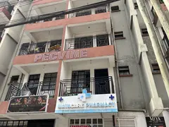
Moveka Station
Mayacare Pharmacy
284 m from the route · send or collect parcels here
4.9 km
Nearest served area: Langata
Highrise
7.8 km
Change here for
16 24C 33SB
Nearest served area: Kilimani
Memorial Hospital
8.3 km
Change here for
16 33SB
Kenyatta Market Flyover
8.9 km
Change here for
16 24C 33NG
Mosque
9.3 km
Change here for
16 24C 33NG
Mbagathi Flats
9.5 km
Change here for
16 24C 33NG
Nearest served area: Kilimani
Kenyatta National Hospital
10.1 km
Change here for
2 3 4 4W and 8 more 8 16 24 24C 32A 33NG 102 111
End Kenyatta National Hospital 10.1 km
Moveka Stations on this route
Drop off or collect a parcel at a shop on the line.
Ready to send? Parcels travel route 34L too. Send from a Station on the line.
Send a package
Stops from Approved SACCOs - University of Nairobi C4D Lab reporting/sharing, service 2019 to 2020.
Map data © OpenStreetMap contributors .