Explore Moveka

Matatu route

24

AmbassadeurKaren/Nakumatt Crossroads

About 24 km between Ambassadeur and Karen/Nakumatt Crossroads, through Nairobi West, Mugumo-ini. 4 Moveka Stations are on or beside the line.

AmbassadeurKaren/Nakumatt Crossroads2 km © OpenStreetMap contributors

The route at a glance

24 km through 4 sections, drawn to scale. Select a section to jump to its stops.

Route 24 at a glanceOverview of route 24 from Ambassadeur to Karen/Nakumatt Crossroads: 24 km through 4 sections, with 59 stages, 1 change point and Moveka Stations beside 3 stages. The ordered list below gives the same information in text.Starehe, 0.0 to 1.1 km, 2 stagesStareheNairobi West, 3.8 to 6.9 km, 8 stagesNairobi WestMugumo-ini, 8.0 to 10.1 km, 6 stagesMugumo-iniKaren, 11.2 to 24.1 km, 43 stagesKaren2Ambassadeur · 0 kmKaren/Nakumatt Crossroads · 24 km
Route 24 at a glanceOverview of route 24 from Ambassadeur to Karen/Nakumatt Crossroads: 24 km through 4 sections, with 59 stages, 1 change point and Moveka Stations beside 3 stages. The ordered list below gives the same information in text.Starehe, 0.0 to 1.1 km, 2 stagesStareheNairobi West, 3.8 to 6.9 km, 8 stagesNairobi WestMugumo-ini, 8.0 to 10.1 km, 6 stagesMugumo-iniKaren, 11.2 to 24.1 km, 43 stagesKaren2Ambassadeur · 0 kmKaren/Nakumatt C… · 24 km

Stops from Ambassadeur to Karen/Nakumatt Crossroads

Show Karen/Nakumatt Crossroads to Ambassadeur
  1. Start
    Ambassadeur
    0.0 km
  2. Starehe

    0.0 km–1.1 km · 2 stages

    Nearest served area: Kamakis

  3. Ambassadeur

    0.0 km

    Change here for 23KS24C33UTW34B

    and 1 more046P

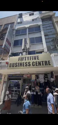
  4. 2 Moveka Stations

    Together here · send or collect parcels at any of them

    0.0 km
  5. Kenya Polytechnic Bus Stop

    1.1 km

    Change here for 2348

    and 8 more12D14A14B151633B33C33IMR

  6. Nairobi West

    3.8 km–6.9 km · 8 stages

    Nearest served area: Langata

  7. 2.7 km to the next stage
  8. Madaraka Flyover

    3.8 km

    Change here for 14B151633SB

    and 2 more125126

  9. Moveka Station

    Samken Electronics

    463 m from the route · send or collect parcels here

    3.8 km
  10. Shell/T-Mall

    4.2 km

    Change here for 14B151633SB

    and 2 more125126

  11. Wilson/AMREF

    4.9 km

    Change here for 1524C34L125

    and 1 more126

  12. Langata Road Primary

    5.0 km

    Change here for 24C34L125126

  13. Amref

    5.3 km

    Change here for 1524C125126

  14. Carnivore/Uchumi Hyper/Dam Estate

    6.2 km

    Change here for 1524C34L125

    and 1 more126

  15. Deliverance Church

    6.7 km

    Change here for 1534L125126

  16. Moveka Station

    Mayacare Pharmacy

    305 m from the route · send or collect parcels here

    6.7 km
  17. Uhuru Garden

    6.9 km

    Change here for 1524C34L125

    and 1 more126

  18. Mugumo-ini

    8.0 km–10.1 km · 6 stages

    Nearest served area: Kibera

  19. Lang'ata

    8.0 km

    Change here for 15125

  20. Langata Barracks

    8.8 km

    Change here for 34L125126

  21. Lang'ata Road Stage/St. Mary'S H

    8.9 km

    Change here for 125126

  22. Nairobi National Park/Orphanage/Cemetary

    9.4 km

    Change here for 24C125126

  23. KWS

    9.6 km
  24. Wildlife Clubs of Kenya

    10.1 km

    Change here for 24C125126

  25. Karen

    11.2 km–24.1 km · 43 stages

    Nearest served area: Rongai

  26. Show the 43 stagesTwiga, Nakumatt Galleria, Npc Karen and 40 more
    • Twiga11.2 km
    • Nakumatt Galleria11.3 km
    • Npc Karen11.8 km
    • CITAM12.0 km
    • Cuea | Catholic University12.0 km
    • Stedmak Garden12.2 km
    • Mokoyeti West12.4 km
    • Kenol/Nairobi Academy12.5 km
    • Mamba12.9 km
    • Tangaza College13.8 km
    • St Lukes Methodist13.9 km
    • Karengata/Cuea/Jkuat Stage14.4 km
    • Kenya School Of Law15.1 km
    • Botanical Gardens15.3 km
    • Matbronze15.5 km
    • Kilimani Junior School15.8 km
    • Hardy Shopping Centre/Hardy Police Station16.1 km
    • Kongoni16.3 km
    • Hardy Manor16.6 km
    • Agribusiness Centre16.8 km
    • Masai Road17.7 km
    • Kordes Roses17.9 km
    • Collingham Gardens/ Mary ward18.0 km
    • Moran Lane/Masai Lane Junction18.5 km
    • Mwangaza18.9 km
    • Masai Lane Bogani Lane Junction19.1 km
    • AOSK19.3 km
    • Ndege Road19.5 km
    • Quarry Lane19.8 km
    • Cemastea/ Research20.3 km
    • Karen Blixen20.4 km
    • KMTC20.9 km
    • Tamambo21.2 km
    • Forest Road21.7 km
    • Cara21.8 km
    • Kambi21.9 km
    • Karen Country Club21.9 km
    • Marula22.3 km
    • Lang'Ata Road Junction/ Go Left22.6 km
    • Brooks23.1 km
    • Don Bosco Boys Training Institut23.6 km
    • Karen Catholic Church23.7 km
    • Karen/Nakumatt Crossroads24.1 km
  27. End
    Karen/Nakumatt Crossroads
    24.1 km

Ready to send?

Parcels travel route 24 too. Send from a Station on the line.

Send a package

Stops from Approved SACCOs - University of Nairobi C4D Lab reporting/sharing, service 2019 to 2020. Map data © OpenStreetMap contributors.