Matatu routes / Route 110
The route at a glance
31 km through 9 sections, drawn to scale. Select a section to jump to its stops.
Route 110 at a glance Overview of route 110 from Kitengela to Easy Coach/Uchumi: 31 km through 9 sections, with 43 stages, 7 change points and Moveka Stations beside 4 stages. The ordered list below gives the same information in text. Oloosirkon/Sholinke, 0.0 to 1.0 km, 2 stages Oloosirkon/Sholinke Athi River, 3.1 to 4.8 km, 4 stages Matathani, 4.9 to 8.2 km, 4 stages Matathani Syokimau-Mulolongo, 8.9 to 14.9 km, 11 stages Syokimau-Mulolongo South C, 15.7 to 25.7 km, 17 stages South C Nairobi West, 27.7 to 27.7 km, 1 stage Nairobi West Woodley/Kenyatta/Golf Course, 28.5 to 28.7 km, 2 stages Starehe, 29.7 to 29.7 km, 1 stage Starehe Kamukunji, 30.9 to 30.9 km, 1 stage Kitengela · 0 kmEasy Coach/Uchumi · 31 kmRoute 110 at a glance Overview of route 110 from Kitengela to Easy Coach/Uchumi: 31 km through 9 sections, with 43 stages, 7 change points and Moveka Stations beside 4 stages. The ordered list below gives the same information in text. Oloosirkon/Sholinke, 0.0 to 1.0 km, 2 stages Oloosirkon/S… Athi River, 3.1 to 4.8 km, 4 stages Matathani, 4.9 to 8.2 km, 4 stages Syokimau-Mulolongo, 8.9 to 14.9 km, 11 stages Syokimau-Mul… South C, 15.7 to 25.7 km, 17 stages South C Nairobi West, 27.7 to 27.7 km, 1 stage Nairobi West Woodley/Kenyatta/Golf Course, 28.5 to 28.7 km, 2 stages Starehe, 29.7 to 29.7 km, 1 stage Starehe Kamukunji, 30.9 to 30.9 km, 1 stage Kitengela · 0 kmEasy Coach/Uchumi · 31 km
Start Kitengela 0.0 km
Nearest served area: Kitengela
Kitengela
0.0 km
Change here for
110AK
Epz
1.0 km
Change here for
110AK
Nearest served area: Kitengela
2.1 km to the next stage
Vanillas
3.1 km
Change here for
110AK
Nearest served area: Mlolongo
Toll
6.2 km
Change here for
110ATH
Sabaki
7.2 km
Change here for
110ATH
Kenchik
8.2 km
Change here for
110ATH
8.9 km–14.9 km · 11 stages
Nearest served area: Mlolongo
Show the 11 stagesMjengo, Mlolongo, Solomon and 8 more Mjengo 8.9 km Mlolongo 9.7 km Solomon 9.9 km Stage Ya Chini 10.4 km Stage Ya Juu 10.8 km Madharau Stage 11.1 km Allpack /Orbit 11.5 km Syokimau 12.5 km Nation 13.7 km Mabati 14.1 km Kapa 14.9 km
15.7 km–25.7 km · 17 stages
Nearest served area: Imara Daima
Show the 17 stagesSyokimau Railway Station, Reliance, SGR and 14 more Syokimau Railway Station 15.7 km Reliance 16.3 km SGR 16.6 km Nice and Lovely 16.9 km Airport Junction 17.3 km Steel Markers 18.7 km Adopt Alight 19.3 km Imara 20.5 km GM 21.7 km Sameer 22.3 km Boby Meal 22.8 km Panari 23.4 km Plaza 2000 23.8 km Airtel 24.3 km St James 24.9 km Shell 25.2 km Belleview 25.7 km
Nearest served area: Nairobi West
2.0 km to the next stage
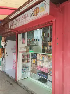
Moveka Station
Samken Electronics
433 m from the route · send or collect parcels here
27.7 km
28.5 km–28.7 km · 2 stages
Nearest served area: Nairobi West
South C
28.5 km
Change here for
11
Nearest served area: Kamakis
Agip
29.7 km
Change here for
2 3 4 8 and 8 more 12D 14A 14B 15 16 24 33B 33C
Nearest served area: Kamkunji
Easy Coach/Uchumi
30.9 km
Change here for
110ATH
End Easy Coach/Uchumi 30.9 km
Moveka Stations on this route
Drop off or collect a parcel at a shop on the line.
Ready to send? Parcels travel route 110 too. Send from a Station on the line.
Send a package
Stops from Approved SACCOs - University of Nairobi C4D Lab reporting/sharing, service 2019 to 2020.
Map data © OpenStreetMap contributors .