The route at a glance
18 km through 9 sections, drawn to scale. Select a section to jump to its stops.
- Stage
- Change here (8+ routes)
- Moveka Station (a number where several stand together)
- Area section
Start
Dagoretti Market0.0 km
Nearest served area: Kiambu kinoo
Allmart Dagoretti Market
0.1 km
Nearest served area: Kiambu Uthiru
Shell Dagoretti Police Station
0.8 km
Change here for
102
Kanisani PCEA Githima
1.0 km
Change here for
102
Gachui/Ruthimitu Chief's Camp
1.5 km
Change here for
102
Mukiriti
1.8 km
Change here for
102
Nearest served area: Kiambu Uthiru
Waithaka
3.4 km
Change here for
102
Muthama
4.2 km
Change here for
102
Nembu Primary School
4.4 km
Change here for
102
Mihonge
4.7 km
Change here for
102
Nearest served area: Mountain view
Beth Mugo Secondary School/Car Wash
5.2 km
Change here for
102
Kwa Ng'ang'a
5.4 km
Change here for
102
AIC Riruta
6.1 km
Change here for
102
Sidia/Equity
6.4 km
Change here for
33U/3046P102 and 1 more
103
Precious Blood Girls' School
6.6 km
Change here for
33U/3046P102 and 1 more
103
Dagoretti CDF/APs' Camp
6.7 km
Change here for
33U/3046P102 and 1 more
103
BP
6.9 km
Change here for
33U/3102103
Mlangosoko
7.1 km
Change here for
33U/3102103
Sugoini
7.5 km
Change here for
33U/3102103
Kinyanjui
7.7 km
Change here for
33U/34102 and 1 more
103
Deliverance Church Riruta
8.2 km
Change here for
33U/34102 and 1 more
103
8.7 km–15.1 km · 17 stages
Nearest served area: Kilimani
Show the 17 stagesMelchizedek Hospital, Riara, Kaberia Junction/Wanyee Stage and 14 more
- Melchizedek Hospital8.7 km
- Riara8.8 km
- Kaberia Junction/Wanyee Stage9.0 km
- Tea Board/Dagoretti Corner9.2 km
- Kenol Dagoretti Corner9.4 km
- Junction9.7 km
- Brew Bistro10.0 km
- Swedish School Nairobi10.4 km
- Posta/Ole Odume Road11.0 km
- Adams Arcade11.7 km
- Kirichwa Road Junction11.9 km
- Prestige/Number Nane12.6 km
- Bishop Magua Centre12.9 km
- China Centre13.6 km
- Coptic/Mimosa13.8 km
- Kenyatta National Hospital14.4 km
- Library15.1 km
Moveka Station
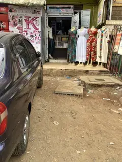
Mira laundromat
475 m from the route · send or collect parcels here
10.4 km
Nearest served area: Kamakis
NHIF
15.6 km
Change here for
341624 and 4 more
33NG56102111
16.7 km–17.8 km · 2 stages
Nearest served area: Kamakis
Agip
16.7 km
Change here for
34812D and 8 more
14A14B15162433B33C33IMR
Railways
17.8 km
Change here for
34856 and 4 more
102111125126
End
Railways17.8 km
Ready to send?
Parcels travel route 2 too. Send from a Station on the line.
Stops from Approved SACCOs - University of Nairobi C4D Lab reporting/sharing, service 2019 to 2020.
Map data © OpenStreetMap contributors.
