The route at a glance
22 km through 9 sections, drawn to scale. Select a section to jump to its stops.
- Stage
- Change here (8+ routes)
- Moveka Station (a number where several stand together)
- Area section
Start
Kikuyu0.0 km
Nearest served area: Kikuyu
Show the 9 stagesKikuyu, Green Gardens School, Gardens and 6 more
- Kikuyu0.0 km
- Green Gardens School0.5 km
- Gardens0.9 km
- Alliance High School1.9 km
- Uon Kikuyu Gate2.1 km
- Uon Kikuyu Gate 22.5 km
- Kirunguro Junction3.1 km
- Zuku/Grace Pop/Dagoretti Flats4.3 km
- Cradles to Crayons4.5 km
Nearest served area: Kiambu Uthiru
Shell
5.0 km
Change here for
2
Kanisani PCEA Githima
5.2 km
Change here for
2
Gachui/Ruthimitu Chief's Camp
5.7 km
Change here for
2
Mukiriti
6.0 km
Change here for
2
Ruthimitu
6.6 km
Change here for
2
Nearest served area: Kiambu Uthiru
Waithaka
7.6 km
Change here for
2
Muthama
8.4 km
Change here for
2
Nembu Primary School
8.6 km
Change here for
2
Mihonge
8.9 km
Change here for
2
9.4 km–10.6 km · 4 stages
Nearest served area: Mountain view
Beth Mugo Secondary School/Car Wash
9.4 km
Change here for
2
Kwa Ng'ang'a
9.6 km
Change here for
2
AIC Riruta
10.3 km
Change here for
2
Sidia/Equity
10.6 km
Change here for
233U/3046P and 1 more
103
10.8 km–10.9 km · 2 stages
Nearest served area: Amboseli (Lavington Area)
Precious Blood Girls' School
10.8 km
Change here for
233U/3046P and 1 more
103
Dagoretti CDF/APs' Camp
10.9 km
Change here for
233U/3046P and 1 more
103
11.1 km–12.4 km · 5 stages
Nearest served area: Amboseli (Lavington Area)
BP
11.1 km
Change here for
233U/3103
Mlangosoko
11.4 km
Change here for
233U/3103
Sugoini
11.7 km
Change here for
233U/3103
Kinyanjui
11.9 km
Change here for
233U/34 and 1 more
103
Deliverance Church Riruta
12.4 km
Change here for
233U/34 and 1 more
103
13.0 km–19.3 km · 18 stages
Nearest served area: Kilimani
Show the 18 stagesRiara, Kaberia Junction/Wanyee Stage, Tea Board/Dagoretti Corner and 15 more
- Riara13.0 km
- Kaberia Junction/Wanyee Stage13.2 km
- Tea Board/Dagoretti Corner13.4 km
- Kenol Dagoretti Corner13.6 km
- Junction13.9 km
- Brew Bistro14.2 km
- Swedish School Nairobi14.6 km
- Posta/Ole Odume Road15.2 km
- Adam's Arcade16.0 km
- Kirichwa Road Junction16.1 km
- Motherland16.3 km
- Prestige/Number Nane16.8 km
- Bishop Magua Center17.1 km
- Uchumi/National Oil17.3 km
- Coptic/Mimosa18.0 km
- Kenyatta National Hospital18.6 km
- Nairobi Area Traffic Police Headquarters19.0 km
- Library19.3 km
Moveka Station
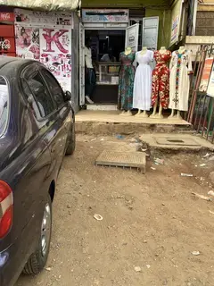
Mira laundromat
475 m from the route · send or collect parcels here
14.6 km
Nearest served area: Kamakis
NHIF
19.8 km
Change here for
23416 and 4 more
2433NG56111
20.9 km–22.0 km · 2 stages
Nearest served area: Kamakis
Agip
20.9 km
Change here for
2348 and 8 more
12D14A14B15162433B33C
Railways
22.0 km
Change here for
2348 and 4 more
56111125126
End
Railways22.0 km
Ready to send?
Parcels travel route 102 too. Send from a Station on the line.
Stops from Approved SACCOs - University of Nairobi C4D Lab reporting/sharing, service 2019 to 2020.
Map data © OpenStreetMap contributors.