Matatu routes / Route 4W
The route at a glance
13 km through 7 sections, drawn to scale. Select a section to jump to its stops.
Route 4W at a glance Overview of route 4W from Kencom/Ambassadeur to Kaberia: 13 km through 7 sections, with 39 stages, 9 change points and Moveka Stations beside 3 stages. The ordered list below gives the same information in text. Starehe, 0.0 to 0.9 km, 2 stages Starehe Kilimani, 1.6 to 2.3 km, 2 stages Kilimani Woodley/Kenyatta/Golf Course, 3.2 to 5.6 km, 5 stages Woodley/Kenyatta/G… Kilimani, 6.0 to 7.3 km, 5 stages Kilimani Woodley/Kenyatta/Golf Course, 7.6 to 8.3 km, 3 stages Woodley/Kenyatta/G… Ngando, 8.8 to 10.2 km, 8 stages Ngando Riruta, 10.4 to 12.9 km, 14 stages Riruta 2 Kencom/Ambassadeur · 0 kmKaberia · 13 kmRoute 4W at a glance Overview of route 4W from Kencom/Ambassadeur to Kaberia: 13 km through 7 sections, with 39 stages, 9 change points and Moveka Stations beside 3 stages. The ordered list below gives the same information in text. Starehe, 0.0 to 0.9 km, 2 stages Starehe Kilimani, 1.6 to 2.3 km, 2 stages Woodley/Kenyatta/Golf Course, 3.2 to 5.6 km, 5 stages Woodley/Keny… Kilimani, 6.0 to 7.3 km, 5 stages Kilimani Woodley/Kenyatta/Golf Course, 7.6 to 8.3 km, 3 stages Ngando, 8.8 to 10.2 km, 8 stages Ngando Riruta, 10.4 to 12.9 km, 14 stages Riruta 2 Kencom/Ambassade… · 0 kmKaberia · 13 km
Start Kencom/Ambassadeur 0.0 km
Nearest served area: Kamakis
Kencom/Ambassadeur
0.0 km
Change here for
5 7C 32A 34B and 3 more 34J 46K 46Y
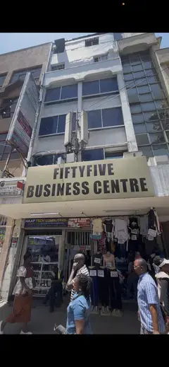
2 Moveka Stations
Together here · send or collect parcels at any of them
0.0 km
GPO
0.9 km
Change here for
5 7C 24C 32A and 4 more 33UTW 46K 046P 46Y
Nearest served area: Kamakis
Serena
1.6 km
Change here for
5 7C 24C 32A and 3 more 46K 046P 46Y
Community
2.3 km
Change here for
7C 32A 56
Nearest served area: Kilimani
Nairobi Area Traffic Police Headquarters
3.2 km
Change here for
2 3 4 8 and 4 more 32A 33NG 102 111
Kenyatta National Hospital
3.6 km
Change here for
2 3 4 8 and 8 more 16 24 24C 32A 33NG 34L 102 111
Coptic/Mimosa
4.4 km
Change here for
2 3 4 8 and 5 more 24 24C 32A 102 111
Uchumi/National Oil
5.1 km
Change here for
2 3 4 8 and 4 more 24C 32A 102 111
Prestige Plaza
5.6 km
Change here for
2 3 4 5 and 4 more 24C 32A 102 111
Nearest served area: Kilimani
Motherland
6.0 km
Change here for
2 3 4 5 and 3 more 24C 102 111
Kirichwa Road
6.2 km
Change here for
2 3 4 5 and 4 more 24 24C 102 111
Adams Arcade
6.4 km
Change here for
2 3 4 5 and 3 more 24 102 111
Posta/Ole Odume Road
7.1 km
Change here for
2 3 4 5 and 4 more 24 24C 102 111
Marsabit Plaza
7.3 km
Change here for
2 3 4 24C and 2 more 102 111
Nearest served area: Jamuhuri
Swedish School Nairobi
7.6 km
Change here for
2 3 4 5 and 4 more 24 24C 102 111
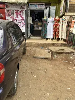
Moveka Station
Mira laundromat
463 m from the route · send or collect parcels here
7.6 km
Jamuhuri/Kibera Station Road
7.9 km
Change here for
2 3 4 5 and 3 more 24C 102 111
Junction
8.3 km
Change here for
2 3 4 24 and 3 more 24C 102 111
8.8 km–10.2 km · 8 stages
Nearest served area: Amboseli (Lavington Area)
Dagoretti Corner Stage
8.8 km
Change here for
2 3 3U/3 4 and 2 more 102 103
Victory World Outreach
9.4 km
Full Gospel Church/Kiruria
9.7 km
Good Samaritan High School
10.1 km
10.4 km–12.9 km · 14 stages
Nearest served area: Amboseli (Lavington Area)
Show the 14 stagesBumps, Joyland, Mutindwa and 11 more Bumps 10.4 km Joyland 10.5 km Mutindwa 10.8 km Kinyanjui Primary School 10.9 km Riruta Parish 11.1 km Riruta Baptist Church 11.7 km Riruta Satellite Primary School 12.1 km Kaberia/Pc Kinyanjui Technical Training Institute 12.2 km New Kaberia Supermarket 12.3 km Simpsons Bar And Rest 12.4 km Kenya Redeemed Church Riruta 12.5 km St. John Othordox Church 12.6 km Muhia Road 12.8 km Kaberia 12.9 km End Kaberia 12.9 km
Moveka Stations on this route
Drop off or collect a parcel at a shop on the line.
Ready to send? Parcels travel route 4W too. Send from a Station on the line.
Send a package
Stops from Approved SACCOs - University of Nairobi C4D Lab reporting/sharing, service 2019 to 2020.
Map data © OpenStreetMap contributors .