Explore Moveka

Matatu route

33SB

Ngumo StageSouth B Stage

About 6 km between Ngumo Stage and South B Stage, through Nyayo Highrise, Mugumo-ini, Nairobi West. 2 Moveka Stations are on or beside the line.

Ngumo StageSouth B Stage2 km © OpenStreetMap contributors

The route at a glance

6 km through 5 sections, drawn to scale. Select a section to jump to its stops.

Route 33SB at a glanceOverview of route 33SB from Ngumo Stage to South B Stage: 6 km through 5 sections, with 13 stages, 0 change points and Moveka Stations beside 2 stages. The ordered list below gives the same information in text.Woodley/Kenyatta/Golf Course, 0.0 to 1.2 km, 3 stagesWoodley/Kenyatta/G…Nyayo Highrise, 1.6 to 1.6 km, 1 stageNyayo HighriseMugumo-ini, 2.2 to 2.5 km, 2 stagesMugumo-iniNairobi West, 2.8 to 4.8 km, 5 stagesNairobi WestNairobi South, 5.7 to 5.9 km, 2 stagesNairobi SouthNgumo Stage · 0 kmSouth B Stage · 6 km
Route 33SB at a glanceOverview of route 33SB from Ngumo Stage to South B Stage: 6 km through 5 sections, with 13 stages, 0 change points and Moveka Stations beside 2 stages. The ordered list below gives the same information in text.Woodley/Kenyatta/Golf Course, 0.0 to 1.2 km, 3 stagesWoodley/Keny…Nyayo Highrise, 1.6 to 1.6 km, 1 stageMugumo-ini, 2.2 to 2.5 km, 2 stagesMugumo-iniNairobi West, 2.8 to 4.8 km, 5 stagesNairobi WestNairobi South, 5.7 to 5.9 km, 2 stagesNairobi SouthNgumo Stage · 0 kmSouth B Stage · 6 km

Stops from Ngumo Stage to South B Stage

Show South B Stage to Ngumo Stage
  1. Start
    Ngumo Stage
    0.0 km
  2. Woodley/Kenyatta/Golf Course

    0.0 km–1.2 km · 3 stages

    Nearest served area: Langata

  3. Ngumo Stage

    0.0 km

    Change here for 33NG

  4. Masadukuni

    0.8 km

    Change here for 33NG34L

  5. Memorial

    1.2 km

    Change here for 1634L

  6. Nyayo Highrise

    1.6 km · 1 stage

    Nearest served area: Langata

  7. Highrise

    1.6 km

    Change here for 1624C34L

  8. Mugumo-ini

    2.2 km–2.5 km · 2 stages

    Nearest served area: Nairobi West

  9. Total/Strathmore

    2.2 km

    Change here for 1624C34L

  10. Blue Sky Estate/T. Mall

    2.5 km

    Change here for 1624C34L

  11. Nairobi West

    2.8 km–4.8 km · 5 stages

    Nearest served area: Nairobi West

  12. Shell

    2.8 km

    Change here for 14B151624

    and 2 more125126

  13. Madaraka Flyover

    3.2 km

    Change here for 14B151624

    and 2 more125126

  14. Uchumi

    3.8 km

    Change here for 14B

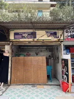
  15. Moveka Station

    Samken Electronics

    146 m from the route · send or collect parcels here

    3.8 km
  16. Mosque

    4.4 km

    Change here for 12C12D

  17. South B Shopping Centre

    4.8 km

    Change here for 12C12D

  18. Nairobi South

    5.7 km–5.9 km · 2 stages

    Nearest served area: South B

  19. Our Lady of Mercy

    5.7 km

    Change here for 11_2

  20. Moveka Station

    Blossom Bee, South B

    269 m from the route · send or collect parcels here

    5.7 km
  21. South B Stage

    5.9 km

    Change here for 1111_2

  22. End
    South B Stage
    5.9 km

Ready to send?

Parcels travel route 33SB too. Send from a Station on the line.

Send a package

Stops from Approved SACCOs - University of Nairobi C4D Lab reporting/sharing, service 2019 to 2020. Map data © OpenStreetMap contributors.