Explore Moveka

Matatu route

11

Bus StationHazina Estate

About 7 km between Bus Station and Hazina Estate, through Landimawe. 1 Moveka Station is on or beside the line.

Bus StationHazina Estate2 km © OpenStreetMap contributors

The route at a glance

7 km through 3 sections, drawn to scale. Select a section to jump to its stops.

Route 11 at a glanceOverview of route 11 from Bus Station to Hazina Estate: 7 km through 3 sections, with 30 stages, 1 change point and Moveka Stations beside 1 stages. The ordered list below gives the same information in text.Starehe, 0.0 to 1.8 km, 2 stagesStareheLandimawe, 2.7 to 4.2 km, 7 stagesLandimaweNairobi South, 4.4 to 7.5 km, 21 stagesNairobi SouthBus Station · 0 kmHazina Estate · 7 km

Stops from Bus Station to Hazina Estate

Show Hazina Estate to Bus Station
  1. Start
    Bus Station
    0.0 km
  2. Starehe

    0.0 km–1.8 km · 2 stages

    Nearest served area: Kamakis

  3. Bus Station

    0.0 km

    Change here for 11_212C12D14A

    and 5 more14B151633MKR43

  4. 1.8 km to the next stage
  5. Shell Haile Selassie Junction

    1.8 km

    Change here for 11_233B33C33TP

    and 2 more125126

  6. Landimawe

    2.7 km–4.2 km · 7 stages

    Nearest served area: South B

  7. Makaburini

    2.7 km

    Change here for 11_2110

  8. Industrial Area/Bazaar

    3.1 km

    Change here for 11_2

  9. Industrial Area Round About

    3.3 km

    Change here for 11_2

  10. Dunga Road/Machakos

    3.5 km

    Change here for 11_2

  11. Car & General

    3.9 km

    Change here for 11_2

  12. Bandari

    4.1 km

    Change here for 11_2

  13. Dar-Es-Salaam

    4.2 km

    Change here for 11_2

  14. Nairobi South

    4.4 km–7.5 km · 21 stages

    Nearest served area: South B

  15. Show the 21 stagesMater Hospital, Mlangoni, Mass and 18 more
    • Mater Hospital4.4 km
    • Mlangoni4.5 km
    • Mass4.8 km
    • Vumira/Mariakani4.9 km
    • South Gate Centre5.1 km
    • Total Petrol Station/Corner5.2 km
    • Kapiti Junction5.3 km
    • Junction5.4 km
    • Mchumbi Road/Shopping Centre5.4 km
    • Harakisha5.4 km
    • Plains View Primary5.8 km
    • Githeri Rise/Highway5.9 km
    • Sori/Olive6.1 km
    • Mombasa Road6.1 km
    • Sana Sana6.4 km
    • Gate A6.8 km
    • Gate C6.8 km
    • Bypass6.9 km
    • Balozi Junction7.2 km
    • Our Lady Secondary7.3 km
    • Hazina Estate7.5 km
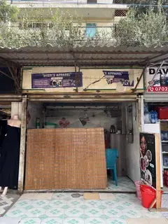
  16. Moveka Station

    Blossom Bee, South B

    90 m from the route · send or collect parcels here

    4.5 km
  17. End
    Hazina Estate
    7.5 km

Ready to send?

Parcels travel route 11 too. Send from a Station on the line.

Send a package

Stops from Approved SACCOs - University of Nairobi C4D Lab reporting/sharing, service 2019 to 2020. Map data © OpenStreetMap contributors.