The route at a glance
12 km through 4 sections, drawn to scale. Select a section to jump to its stops.
- Stage
- Change here (8+ routes)
- Moveka Station (a number where several stand together)
- Area section
Start
Bus Station0.0 km
Nearest served area: Kamkunji
Bus Station
0.0 km
Change here for
1111_212C12D and 5 more
14A14B151643
Nearest served area: Nairobi West
3.2 km to the next stage
Moveka Station
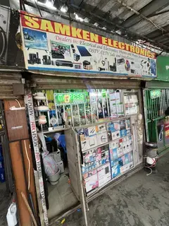
Samken Electronics
464 m from the route · send or collect parcels here
3.2 km
Government Plaza/Devis
3.7 km
Change here for
12C12D33B33C and 6 more
33FED33IMR33TP33UTW110110ATH
Nearest served area: South B
Show the 9 stagesCapital Centre, Belleview, St. James and 6 more
- Capital Centre4.7 km
- Belleview5.3 km
- St. James6.0 km
- Park Side Towers/Airtel6.7 km
- Vision Plaza7.1 km
- Panari7.5 km
- Standard Group8.0 km
- Tulip8.6 km
- Sameer9.0 km
9.3 km–11.9 km · 8 stages
Nearest served area: Imara Daima
GM
9.3 km
Change here for
33B33C33FED33IMR and 4 more
33TP33UTW110110ATH
Imara Daima
10.7 km
Change here for
33IMR
Moveka Station

Imara Carpets
199 m from the route · send or collect parcels here
10.7 km
End
St. Bakhita11.9 km
Ready to send?
Parcels travel route 33MKR too. Send from a Station on the line.
Stops from Approved SACCOs - University of Nairobi C4D Lab reporting/sharing, service 2019 to 2020.
Map data © OpenStreetMap contributors.
