Matatu routes / Route 23KS
The route at a glance
12 km through 7 sections, drawn to scale. Select a section to jump to its stops.
Route 23KS at a glance Overview of route 23KS from Gill House to Civil Servant/Deliverance Church: 12 km through 7 sections, with 34 stages, 5 change points and Moveka Stations beside 2 stages. The ordered list below gives the same information in text. Starehe, 0.0 to 0.0 km, 1 stage Starehe Kamukunji, 1.7 to 1.9 km, 2 stages Kamukunji Pumwani, 2.8 to 3.6 km, 4 stages Pumwani Maringo/Hamza, 4.2 to 5.6 km, 6 stages Maringo/Hamza Harambee, 5.9 to 6.3 km, 3 stages Harambee Uhuru, 6.4 to 8.7 km, 12 stages Uhuru Kariobangi South, 10.4 to 11.7 km, 6 stages Kariobangi South Gill House · 0 kmCivil Servant/Deliverance Church · 12 kmRoute 23KS at a glance Overview of route 23KS from Gill House to Civil Servant/Deliverance Church: 12 km through 7 sections, with 34 stages, 5 change points and Moveka Stations beside 2 stages. The ordered list below gives the same information in text. Starehe, 0.0 to 0.0 km, 1 stage Starehe Kamukunji, 1.7 to 1.9 km, 2 stages Pumwani, 2.8 to 3.6 km, 4 stages Pumwani Maringo/Hamza, 4.2 to 5.6 km, 6 stages Maringo/Hamza Harambee, 5.9 to 6.3 km, 3 stages Uhuru, 6.4 to 8.7 km, 12 stages Uhuru Kariobangi South, 10.4 to 11.7 km, 6 stages Kariobangi S… Gill House · 0 kmCivil Servant/De… · 12 km
Start Gill House 0.0 km
Nearest served area: Kamakis
Gill House
0.0 km
Change here for
24 24C 34B
Nearest served area: Kamkunji
1.7 km to the next stage
Nacico
1.7 km
Change here for
11_2 19Cdc 33GTB 34B and 5 more 34J 39SK 58 1960 1961K
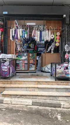
Moveka Station
Aura Collections
454 m from the route · send or collect parcels here
1.7 km
Landhies
1.9 km
Change here for
11 19Cdc 35/60 39SK
Nearest served area: Kamkunji
City Stadium
2.8 km
Change here for
10 19Cdc 33DP 33GTB and 8 more 34B 34J 35/60 36 38/39 39SK 58 70/71
Shauri Moyo
3.0 km
Change here for
10 19Cdc 33DP 33GTB and 8 more 33TP 34B 34J 35/60 36 38/39 39SK 58
Nearest served area: Buruburu phase 2
Mt Kenya Bar Shauri Moyo
4.2 km
Morisson Primary School
4.7 km
Bahati Primary School Kag Bahati
5.0 km
Change here for
26S
Kimathi/Section 3 Junction
5.1 km
Change here for
26S
Dr. Livingstone Primary School
5.5 km
Change here for
26S
Nearest served area: Buruburu phase 2
Jerusalem Shopping Centre
5.9 km
Change here for
26S
Uhuru Secondary
6.2 km
Change here for
26S
Uhuru Shopping Centre
6.3 km
Change here for
26 26S
6.4 km–8.7 km · 12 stages
Nearest served area: Buruburu phase 2
Show the 12 stagesUhuru Primary, Uhuru Junction, Kwa Garage and 9 more Uhuru Primary 6.4 km Uhuru Junction 6.7 km Kwa Garage 6.7 km Kiambiu 6.8 km Kobil Calvary Temple 7.1 km Buru Roundabout 7.4 km Neighbours Buruburu Phase 1 7.7 km Buru 1 Primary 7.7 km Phase 1 Stage 8.1 km Raphael 8.3 km Pioneer Estate 8.4 km Total Outering road 8.7 km
10.4 km–11.7 km · 6 stages
Nearest served area: Kariobangi north
1.8 km to the next stage
Mahutini/Southend
10.4 km
Change here for
17A 17Aky 26 26S and 1 more 36
Corner
10.5 km
Change here for
17A 36
Kariobangi south Primary
10.6 km
Change here for
36
Kwa Chief
11.1 km
Change here for
36
Friends Inn
11.3 km
Change here for
36
Civil Servant/Deliverance Church
11.7 km
Change here for
36
End Civil Servant/Deliverance Church 11.7 km
Moveka Stations on this route
Drop off or collect a parcel at a shop on the line.
Ready to send? Parcels travel route 23KS too. Send from a Station on the line.
Send a package
Stops from Approved SACCOs - University of Nairobi C4D Lab reporting/sharing, service 2019 to 2020.
Map data © OpenStreetMap contributors .