Explore Moveka

Matatu route

1961K

Kayole OneLadhies Road/OTC

About 15 km between Kayole One and Ladhies Road/OTC, through Komarock, Kayole Central, Kayole South, Upper Savannah. 3 Moveka Stations are on or beside the line.

Kayole OneLadhies Road/OTC2 km © OpenStreetMap contributors

The route at a glance

15 km through 11 sections, drawn to scale. Select a section to jump to its stops.

Stops from Kayole One to Ladhies Road/OTC

Show Ladhies Road/OTC to Kayole One
  1. Start
    Kayole One
    0.0 km
  2. Njiru

    0.0 km · 1 stage

    Nearest served area: Njiru

  3. Kayole One

    0.0 km

    Change here for 17A17Aky201960

  4. Komarock

    0.4 km · 1 stage

    Nearest served area: Bee center Nasra Kayole

  5. Step 1

    0.4 km

    Change here for 17A17Aky19C219Cdc

    and 2 more201960

  6. Kayole Central

    0.6 km–2.0 km · 6 stages

    Nearest served area: Bee center Nasra Kayole

  7. Tushauriane

    0.6 km

    Change here for 16/6217A17Aky19C2

    and 3 more19Cdc201960

  8. Kayole Hospital

    1.4 km

    Change here for 16/6217A17Aky18C

    and 3 more2019601961Kd

  9. Kwa Chief

    1.6 km

    Change here for 16/6217Aky18C20

    and 2 more19601961Kd

  10. Sabasaba

    1.7 km

    Change here for 16/6217A17Aky18C

    and 3 more2019601961Kd

  11. Maria

    1.9 km

    Change here for 16/6217A17Aky18C

    and 3 more2019601961Kd

  12. Raster

    2.0 km

    Change here for 16/6217A17Aky18C

    and 3 more2019601961Kd

  13. Kayole South

    2.1 km–3.2 km · 4 stages

    Nearest served area: Bee center Nasra Kayole

  14. Prime Rose

    2.1 km

    Change here for 16/6217A17Aky18C

    and 3 more2019601961Kd

  15. Nyando

    2.3 km

    Change here for 16/6217A17Aky18C

    and 3 more2019601961Kd

  16. Kwa DO

    3.0 km

    Change here for 16/6217A17Aky18C

    and 3 more19Cdc19601961Kd

  17. Nyama Villa

    3.2 km

    Change here for 17A17Aky19Cdc1960

    and 1 more1961Kd

  18. Upper Savannah

    3.5 km–4.3 km · 5 stages

    Nearest served area: Bee center Nasra Kayole

  19. Masimba/Overcomers

    3.5 km

    Change here for 17A17Aky19Cdc20

    and 2 more19601961Kd

  20. Summers

    3.6 km

    Change here for 17A17Aky19Cdc20

    and 2 more19601961Kd

  21. Shujaa Mall

    3.9 km

    Change here for 17A17Aky19Cdc20

    and 2 more19601961Kd

  22. Sosian Estate

    4.0 km

    Change here for 17A17Aky19Cdc20

    and 2 more19601961Kd

  23. Bee Centre

    4.3 km

    Change here for 17A17Aky19Cdc20

    and 1 more1961Kd

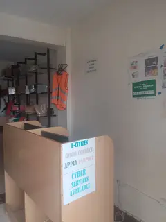
  24. Moveka Station

    Blackside Tech Cyber Bee center

    36 m from the route · send or collect parcels here

    4.3 km
  25. Lower Savannah

    4.7 km–7.4 km · 12 stages

    Nearest served area: Donholm greenspan

  26. Show the 12 stagesGreen Span Estate, Jacaranda, Phase 8 and 9 more
    • Green Span Estate4.7 km
    • Jacaranda4.8 km
    • Phase 85.0 km
    • Tuskys5.3 km
    • Phase 55.6 km
    • Harambee Sacco5.7 km
    • Epren Academy6.2 km
    • Tumaini6.5 km
    • Savanna6.6 km
    • Mara Savanna6.7 km
    • Kisumu Ndogo7.1 km
    • Caltex/Total7.4 km
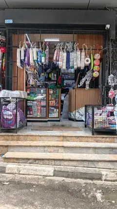
  27. Moveka Station

    Arcade link

    41 m from the route · send or collect parcels here

    5.3 km
  28. Harambee

    8.5 km · 1 stage

    Nearest served area: Buruburu phase 2

  29. Donholm Interchange/Stage

    8.5 km

    Change here for 19Cdc33DP33GTB33TP

    and 6 more34B34J35/6038/3939SK1960

  30. Viwandani

    9.2 km–10.1 km · 3 stages

    Nearest served area: Buruburu phase 2

  31. Tom Mboya Hall

    9.2 km

    Change here for 19Cdc33DP33GTB33TP

    and 6 more34B34J35/6038/3939SK1960

  32. Hamza

    9.5 km

    Change here for 19Cdc33DP33GTB33TP

    and 8 more34B34J35/603638/3939SK581960

  33. Total Jogoo Road/Mogas

    10.1 km

    Change here for 19Cdc33DP33GTB33TP

    and 8 more34B34J35/603638/3939SK581960

  34. Makongeni

    10.4 km–13.2 km · 7 stages

    Nearest served area: Kamkunji

  35. Nile Junction

    10.4 km

    Change here for 19Cdc2633TP34B

    and 4 more34J35/6038/3958

  36. Makadara/DC Jogoo Road

    11.0 km

    Change here for 1019Cdc2633DP

    and 8 more33GTB33TP34B34J35/603638/3939SK

  37. Posta

    11.5 km

    Change here for 1019Cdc33DP33GTB

    and 8 more33TP34B34J35/603638/3939SK58

  38. Church Army

    12.0 km

    Change here for 6E1019Cdc23KS

    and 8 more33DP33GTB33TP34B34J35/603638/39

  39. Maziwa

    12.7 km

    Change here for 1019Cdc23KS33DP

    and 8 more33GTB33TP34B34J35/603638/3939SK

  40. Kaloleni

    12.8 km

    Change here for 1019Cdc23KS33DP

    and 8 more33GTB33TP34B34J35/603638/3939SK

  41. City Stadium

    13.2 km

    Change here for 1019Cdc23KS33DP

    and 8 more33GTB33TP34B34J35/603638/3939SK

  42. Kamukunji

    13.9 km–14.4 km · 2 stages

    Nearest served area: Kamkunji

  43. Nacico

    13.9 km

    Change here for 11_219Cdc23KS33GTB

    and 7 more33TP34B34J35/6039SK581960

  44. Country Bus

    14.4 km

    Change here for 1119Cdc23KS33GTB

    and 7 more33TP34B34J35/6039SK581960

  45. Starehe

    15.0 km · 1 stage

    Nearest served area: Kamkunji

  46. Ladhies Road/OTC

    15.0 km

    Change here for 1960

  47. Moveka Station

    Aura Collections

    154 m from the route · send or collect parcels here

    15.0 km
  48. End
    Ladhies Road/OTC
    15.0 km

Ready to send?

Parcels travel route 1961K too. Send from a Station on the line.

Send a package

Stops from Approved SACCOs - University of Nairobi C4D Lab reporting/sharing, service 2019 to 2020. Map data © OpenStreetMap contributors.