The route at a glance
35 km through 12 sections, drawn to scale. Select a section to jump to its stops.
- Stage
- Change here (8+ routes)
- Moveka Station (a number where several stand together)
- Area section
Start
OTC0.0 km
Nearest served area: Kamkunji
Moveka Station

Aura Collections
400 m from the route · send or collect parcels here
0.0 km
Nearest served area: Kenol
Kariokor
1.4 km
Change here for
3N71416/62 and 8 more
17B2732D4345G46B46H121
Nearest served area: Eastleigh
2.0 km to the next stage
Pangani/Muthaiga Footbridge
3.4 km
Change here for
11C17B2525A and 8 more
2729/304344G44Z45G45K49
Muthaiga Bus Stage
4.2 km
Change here for
100100A121
Karura Close
4.5 km
Change here for
100
Nearest served area: Four-ways Kiambu road
Kenya Forestry Service Station/CID
5.2 km
Change here for
100100A121
Shark's Palace
6.4 km
Change here for
100100A121
Rock City
6.7 km
Change here for
100100A121
JCL Motors
7.0 km
Change here for
100100A
Wanderjoy
7.5 km
Change here for
100100A121
Nearest served area: Four-ways Kiambu road
Jikoni's
7.7 km
Change here for
100100A
Ridgeway Springs/Total
7.8 km
Change here for
100100A121
Nearest served area: Four-ways Kiambu road
Naivas Ciata Mall/Ridgeways Mall
8.3 km
Change here for
100100A121
Runda Junction
8.8 km
Change here for
100100A121
Githogoro
9.2 km
Change here for
100100A121
Bypass/Kwaheri Flyover
9.6 km
Change here for
100100A107D121
9.9 km–16.2 km · 17 stages
Nearest served area: Kasarini thindigua kiambu
Show the 17 stagesBalkan Sec. School/Fourways, Evergreen, Kasarini and 14 more
- Balkan Sec. School/Fourways9.9 km
- Evergreen10.1 km
- Kasarini10.7 km
- Brentwood Hotel10.8 km
- Quickmart11.1 km
- Thindigwa11.4 km
- Mushroom12.0 km
- Barua12.4 km
- Kwa Ng'ethe/Fivestar12.7 km
- Itara13.3 km
- KIST13.5 km
- Kirigiti/Ruui14.0 km
- Kwa DO/Kiambu Limuru Junction14.6 km
- Total Kiambu15.1 km
- Kwa Ahindi15.3 km
- Old Kiambu15.6 km
- Kiambu Terminus16.2 km
Moveka Station
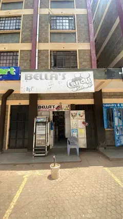
Bellas candy shop
96 m from the route · send or collect parcels here
10.8 km
Nearest served area: Kiambu town
Kiambu Mall/Posta
16.5 km
Change here for
121
17.1 km–19.6 km · 7 stages
Nearest served area: Kiambu town
Overcomer's Chapel
17.5 km
Change here for
121
Redeemed Ndumberi
18.8 km
Change here for
121
Ndumberi
19.1 km
Change here for
121
20.5 km–23.0 km · 4 stages
Nearest served area: Kiambu town
Jehova Witness Ting'ang'a
23.0 km
24.0 km–27.9 km · 9 stages
Show the 9 stagesNgemwa, Police Post, Aipcea and 6 more
- Ngemwa24.0 km
- Police Post24.2 km
- Aipcea24.4 km
- Redeemed Ngemwa24.8 km
- Thingira25.4 km
- Raia26.4 km
- SDA Ikinu27.3 km
- Ikinu Primary27.6 km
- Ikinu27.9 km
29.5 km–35.3 km · 10 stages
Show the 10 stagesPCEA Bishop Gathu, Gathanji, Gititu Coffee Factory and 7 more
- PCEA Bishop Gathu29.5 km
- Gathanji30.1 km
- Gititu Coffee Factory30.7 km
- Jamaica31.8 km
- Kiangima32.7 km
- Makutano34.1 km
- Beta Health Care34.3 km
- AIPCK Githunguri34.9 km
- Githunguri Township35.1 km
- Githunguri Terminal35.3 km
End
Githunguri Terminal35.3 km
Ready to send?
Parcels travel route 120 too. Send from a Station on the line.
Stops from Approved SACCOs - University of Nairobi C4D Lab reporting/sharing, service 2019 to 2020.
Map data © OpenStreetMap contributors.