The route at a glance
8 km through 5 sections, drawn to scale. Select a section to jump to its stops.
- Stage
- Change here (8+ routes)
- Moveka Station (a number where several stand together)
- Area section
Start
Muthurwa0.0 km
Nearest served area: Kamkunji
Muthurwa
0.0 km
Change here for
1033DP38/3969
Moveka Station
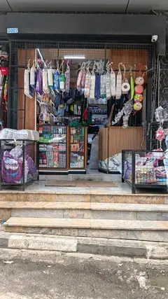
Aura Collections
340 m from the route · send or collect parcels here
0.0 km
Nearest served area: Kamkunji
City Stadium
1.3 km
Change here for
1019Cdc23KS33DP and 8 more
33GTB34B34J35/603638/3939SK58
Nearest served area: Kamkunji
Church Army
2.4 km
Change here for
6E1019Cdc33DP and 8 more
33GTB33TP34B34J35/603638/3939SK
Nearest served area: South B
3.7 km–8.0 km · 17 stages
Nearest served area: Imara Daima
Show the 17 stagesLondiani Road, BAT, KIE and 14 more
- Londiani Road3.7 km
- BAT3.9 km
- KIE4.0 km
- Viwandani4.2 km
- House Of Manji4.4 km
- Mamba4.7 km
- Lunga Lunga Square4.8 km
- Mareba5.0 km
- Mogadishu Road5.1 km
- Patco5.4 km
- Pate Road5.7 km
- Tanga Road6.3 km
- Tuskys6.5 km
- Sinai6.9 km
- Crescent7.2 km
- Uchumi7.5 km
- Donholm8.0 km
End
Donholm8.0 km
Ready to send?
Parcels travel route 70/71 too. Send from a Station on the line.
Stops from Approved SACCOs - University of Nairobi C4D Lab reporting/sharing, service 2019 to 2020.
Map data © OpenStreetMap contributors.
