The route at a glance
11 km through 5 sections, drawn to scale. Select a section to jump to its stops.
- Stage
- Change here (8+ routes)
- Moveka Station (a number where several stand together)
- Area section
Start
Kangemi Terminus0.0 km
Nearest served area: Kangemi
Kangemi Terminus
0.0 km
Change here for
105
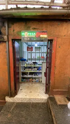
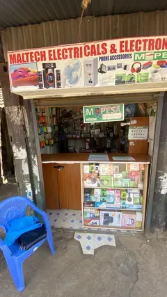
2 Moveka Stations
Together here · send or collect parcels at any of them
0.0 km
Nearest served area: Kangemi
Heshima Supermarket/Stagi ya Basi
0.6 km
Change here for
30105114W115 and 1 more
135
Sodom
0.9 km
Change here for
30046P105114W and 2 more
115135
CCK/Kianda School
1.3 km
Change here for
30105114W115 and 1 more
135
Waruku/Deloitte
2.0 km
Change here for
30046P105114W and 2 more
115135
Nairobi School
2.9 km
Change here for
30105114W115 and 1 more
135
Kari/James Gichuru
3.3 km
Change here for
30046P48K105 and 3 more
114W115135
Nearest served area: Westlands Area
Show the 9 stagesKabete Barracks/ABC, Njuguna's, Westlands DC/Church Road/Safaricom and 6 more
- Kabete Barracks/ABC3.7 km
- Njuguna's3.9 km
- Westlands DC/Church Road/Safaricom4.6 km
- Westlands Primary School5.0 km
- Brookside5.2 km
- Lion's Place5.5 km
- St. Marks Church/Lion's Place5.7 km
- Gama Pinto Road6.1 km
- Westlands Stage6.6 km
Nearest served area: Westlands Area
Eden Square/ICEA
7.1 km
Change here for
3048C105114W and 2 more
115135
Chiromo/Mirage
7.4 km
Change here for
3048A48B48C and 5 more
48O105114W115135
Museum
8.0 km
Change here for
30046P48A48B and 4 more
48C105115135
9.1 km–10.7 km · 2 stages
Nearest served area: Nairobi CBD
Main Campus/University Way
9.1 km
Change here for
30046P48A48B and 5 more
48C48O105114W115
1.6 km to the next stage
Odeon
10.7 km
Change here for
11A11B11C25 and 8 more
25A3044G44Z45K48A48B48C
2 Moveka Stations
Together here · send or collect parcels at any of them
10.7 km
End
Odeon10.7 km
Ready to send?
Parcels travel route 23KG too. Send from a Station on the line.
Stops from Approved SACCOs - University of Nairobi C4D Lab reporting/sharing, service 2019 to 2020.
Map data © OpenStreetMap contributors.