Explore Moveka

Matatu route

1960

Ladhies Road/OTCKayole 1

About 14 km between Ladhies Road/OTC and Kayole 1, through Kamukunji, Pumwani, Maringo/Hamza, Harambee. 2 Moveka Stations are on or beside the line.

Ladhies Road/OTCKayole 12 km © OpenStreetMap contributors

The route at a glance

14 km through 11 sections, drawn to scale. Select a section to jump to its stops.

Stops from Ladhies Road/OTC to Kayole 1

Show Kayole 1 to Ladhies Road/OTC
  1. Start
    Ladhies Road/OTC
    0.0 km
  2. Starehe

    0.0 km · 1 stage

    Nearest served area: Kamkunji

  3. Ladhies Road/OTC

    0.0 km

    Change here for 1961K

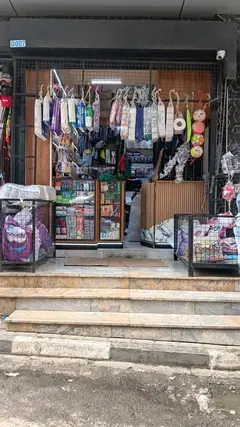
  4. Moveka Station

    Aura Collections

    154 m from the route · send or collect parcels here

    0.0 km
  5. Kamukunji

    1.8 km · 1 stage

    Nearest served area: Kamkunji

  6. 1.8 km to the next stage
  7. Nacico

    1.8 km

    Change here for 11_219Cdc23KS33GTB

    and 5 more34B34J39SK581961K

  8. Pumwani

    2.8 km–3.4 km · 3 stages

    Nearest served area: Kamkunji

  9. City Stadium

    2.8 km

    Change here for 1019Cdc23KS33DP

    and 8 more33GTB34B34J35/603638/3939SK58

  10. Shauri Moyo

    3.1 km

    Change here for 1019Cdc23KS33DP

    and 8 more33GTB33TP34B34J35/603638/3939SK

  11. Maziwa

    3.4 km

    Change here for 1019Cdc23KS33DP

    and 8 more33GTB34B34J35/603638/3939SK58

  12. Maringo/Hamza

    3.9 km–6.4 km · 5 stages

    Nearest served area: Buruburu phase 2

  13. Church Army

    3.9 km

    Change here for 6E1019Cdc33DP

    and 8 more33GTB33TP34B34J35/603638/3939SK

  14. Posta

    4.2 km

    Change here for 1019Cdc33DP33GTB

    and 8 more33TP34B34J35/603638/3939SK58

  15. Uchumi-Jogoo Road

    4.9 km

    Change here for 1019Cdc2633DP

    and 8 more33GTB33TP34B34J35/603638/3939SK

  16. Mogas

    5.8 km

    Change here for 19Cdc33DP33GTB33TP

    and 8 more34B34J35/603638/3939SK581961K

  17. Hamza

    6.4 km

    Change here for 19Cdc33DP33GTB34B

    and 7 more34J35/603638/3939SK581961K

  18. Harambee

    6.7 km–7.4 km · 2 stages

    Nearest served area: Buruburu phase 2

  19. Tom Mboya Hall

    6.7 km

    Change here for 19Cdc33DP33GTB33TP

    and 6 more34B34J35/6038/3939SK1961K

  20. Donholm Stage

    7.4 km

    Change here for 19Cdc33DP33GTB33TP

    and 6 more34B34J35/6038/3939SK1961K

  21. Lower Savannah

    7.9 km · 1 stage

    Nearest served area: Buruburu phase 2

  22. Manyanja

    7.9 km

    Change here for 19C219Cdc35/6039SK

    and 1 more3560_2

  23. Umoja II

    8.1 km–9.9 km · 4 stages

    Nearest served area: Bee center Nasra Kayole

  24. Tena

    8.1 km

    Change here for 19Cdc35/603560_2

  25. Car Wash

    8.7 km

    Change here for 19Cdc

  26. Manyanja Road Round About

    9.4 km

    Change here for 19Cdc

  27. Bee Centre

    9.9 km

    Change here for 17Aky19Cdc20

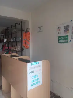
  28. Moveka Station

    Blackside Tech Cyber Bee center

    110 m from the route · send or collect parcels here

    9.9 km
  29. Komarock

    10.4 km · 1 stage

    Nearest served area: Bee center Nasra Kayole

  30. Sosian Estate

    10.4 km

    Change here for 17A17Aky19Cdc20

    and 2 more1961K1961Kd

  31. Kayole South

    10.8 km–12.4 km · 8 stages

    Nearest served area: Bee center Nasra Kayole

  32. Masimba

    10.8 km

    Change here for 17A17Aky19Cdc20

    and 2 more1961K1961Kd

  33. Junction

    11.2 km

    Change here for 20

  34. Post

    11.6 km

    Change here for 17A17Aky20

  35. Soweto

    11.7 km

    Change here for 17A17Aky20

  36. Kioi

    11.9 km

    Change here for 17A17Aky20

  37. Nyando

    12.1 km

    Change here for 16/6217A17Aky18C

    and 3 more201961K1961Kd

  38. Prime Rose

    12.3 km

    Change here for 16/6217A17Aky18C

    and 3 more201961K1961Kd

  39. Rasta

    12.4 km

    Change here for 16/6217A17Aky18C

    and 3 more201961K1961Kd

  40. Kayole Central

    12.6 km–13.3 km · 8 stages

    Nearest served area: Bee center Nasra Kayole

  41. Maria

    12.6 km

    Change here for 16/6217A17Aky18C

    and 3 more201961K1961Kd

  42. Sabasaba

    12.7 km

    Change here for 16/6217A17Aky18C

    and 3 more201961K1961Kd

  43. Kwa Chief

    12.9 km

    Change here for 16/6217Aky18C20

    and 2 more1961K1961Kd

  44. Goa Kayole Church

    12.9 km

    Change here for 16/6217Aky18C20

    and 2 more1961K1961Kd

  45. Diesel

    13.0 km

    Change here for 16/6217A17Aky18C

    and 3 more201961K1961Kd

  46. Kayole Hospital/Biason Road

    13.1 km

    Change here for 16/6217A17Aky18C

    and 3 more201961K1961Kd

  47. Prestige/ Kayole Center

    13.1 km

    Change here for 16/6217A17Aky18C

    and 3 more201961K1961Kd

  48. Kona/Bambo Villa

    13.3 km

    Change here for 16/6217A17Aky18C

    and 1 more20

  49. Njiru

    13.6 km–14.5 km · 5 stages

    Nearest served area: Njiru

  50. Nyora

    13.6 km

    Change here for 17A17Aky

  51. Mihang'o

    13.8 km

    Change here for 17A17Aky

  52. Sowematt

    14.1 km

    Change here for 17A17Aky

  53. Kona Mbaya

    14.2 km

    Change here for 17Aky

  54. Kayole 1

    14.5 km

    Change here for 17A17Aky201961K

  55. End
    Kayole 1
    14.5 km

Ready to send?

Parcels travel route 1960 too. Send from a Station on the line.

Send a package

Stops from Approved SACCOs - University of Nairobi C4D Lab reporting/sharing, service 2019 to 2020. Map data © OpenStreetMap contributors.