The route at a glance
37 km through 9 sections, drawn to scale. Select a section to jump to its stops.
- Stage
- Change here (8+ routes)
- Moveka Station (a number where several stand together)
- Area section
Start
Koja0.0 km
Nearest served area: Nairobi CBD
Koja
0.0 km
Change here for
611C23W25 and 8 more
25A44G44Z45K46B46H106116
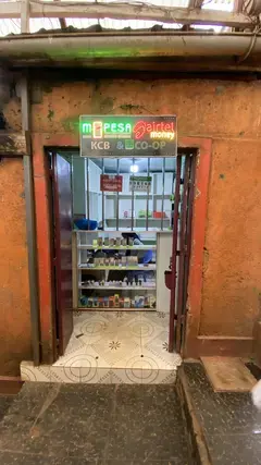
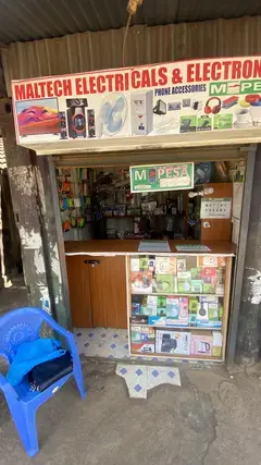
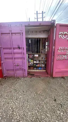
3 Moveka Stations
Together here · send or collect parcels at any of them
0.0 km
2.9 km–9.4 km · 17 stages
Nearest served area: Westlands Area
Show the 17 stagesChiromo, Consolata, Delta/CFC and 14 more
- Chiromo2.9 km
- Consolata3.2 km
- Delta/CFC3.6 km
- Westlands/Parklands Baptist4.1 km
- St. Marks/Lion's Place4.4 km
- Lion's Place4.6 km
- Westlands DC/Church Road/Safaricom/Brookside Drive5.0 km
- AACC/Safaricom/Church Road5.6 km
- Aga Khan High School6.1 km
- ABC Place6.6 km
- James Gichuru Junction6.9 km
- KARI7.1 km
- Nairobi School7.4 km
- Deloitte/Waruku8.2 km
- Afralti/X-Telcom8.6 km
- Kianda School8.9 km
- Sodom9.4 km
9.6 km–11.9 km · 5 stages
Nearest served area: Mountain view
Posta
9.6 km
Change here for
23KG30105114W and 1 more
135
Kangemi Market
10.0 km
Change here for
046P114W135
2 Moveka Stations
Together here · send or collect parcels at any of them
10.0 km
Mountain View/Total
11.1 km
Change here for
30105114W
Thiong'o Road
11.4 km
Change here for
30046P
Custoil/Thiong'o
11.9 km
Change here for
046P
12.2 km–12.6 km · 2 stages
Nearest served area: Mountain view
Nne Market
12.2 km
Change here for
30046P105114W and 1 more
135
Kabete Police Station
12.6 km
Change here for
105114W135
Nearest served area: Kiambu Uthiru
Uthiru
13.6 km
Change here for
33U/3103105 and 2 more
114W135
Moveka Station
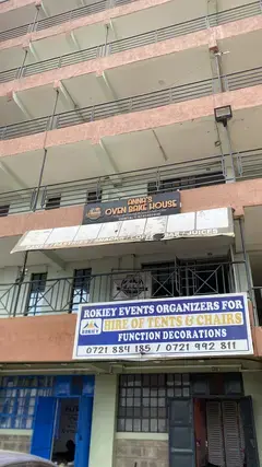
Anna’s Oven
433 m from the route · send or collect parcels here
13.6 km
15.3 km–18.1 km · 4 stages
Nearest served area: Kiambu kinoo
1.7 km to the next stage
87
15.3 km
Change here for
3103105114W and 1 more
135
Kinoo
15.9 km
Change here for
3103114W135
Muthiga
17.3 km
Change here for
114W135
Regen
18.1 km
Change here for
103105114W135
18.6 km–20.0 km · 2 stages
Nearest served area: Kikuyu
Rungiri
18.6 km
Change here for
103105114W135
Kampala
20.0 km
Change here for
114W135
20.8 km–28.7 km · 13 stages
Nearest served area: Kikuyu
Show the 13 stagesHa Gichuru, Sigona, Winda Hotel and 10 more
- Ha Gichuru20.8 km
- Sigona21.3 km
- Winda Hotel22.1 km
- Kiambaa23.4 km
- Zambezi24.1 km
- Gicini25.2 km
- Kiambea25.7 km
- Muguga26.0 km
- Site26.7 km
- Ika Ithano27.0 km
- Ha Joram27.1 km
- Pel28.0 km
- Swatch Place28.7 km
29.1 km–37.3 km · 11 stages
Show the 11 stagesChunga Mali, Rironi, Kambembe and 8 more
- Chunga Mali29.1 km
- Rironi29.6 km
- Kambembe31.1 km
- Kampala31.8 km
- Kamandura Junction32.4 km
- Kamirithu33.8 km
- Kwa Mbira34.6 km
- Kwambira Soko35.3 km
- Kwa Mbira35.4 km
- Ngenia36.6 km
- Limuru Town Terminal37.3 km
End
Limuru Town Terminal37.3 km
Ready to send?
Parcels travel route 115 too. Send from a Station on the line.
Stops from Approved SACCOs - University of Nairobi C4D Lab reporting/sharing, service 2019 to 2020.
Map data © OpenStreetMap contributors.