Explore Moveka

Matatu route

39

Super HighwayTransami

About 27 km between Super Highway and Transami, through Mwiki, Ruai, Njiru, Embakasi. 3 Moveka Stations are on or beside the line.

Super HighwayTransami2 km © OpenStreetMap contributors

The route at a glance

27 km through 8 sections, drawn to scale. Select a section to jump to its stops.

Route 39 at a glanceOverview of route 39 from Super Highway to Transami: 27 km through 8 sections, with 34 stages, 0 change points and Moveka Stations beside 3 stages. The ordered list below gives the same information in text.Gatongora, 0.0 to 4.7 km, 7 stagesGatongoraMwiki, 9.4 to 11.0 km, 3 stagesMwikiRuai, 13.7 to 15.1 km, 3 stagesRuaiNjiru, 15.8 to 15.8 km, 1 stageNjiruEmbakasi, 16.1 to 16.8 km, 5 stagesEmbakasiNjiru, 17.1 to 18.7 km, 6 stagesNjiruEmbakasi, 19.3 to 24.6 km, 7 stagesEmbakasiPipeline, 26.3 to 26.9 km, 2 stagesPipelineSuper Highway · 0 kmTransami · 27 km
Route 39 at a glanceOverview of route 39 from Super Highway to Transami: 27 km through 8 sections, with 34 stages, 0 change points and Moveka Stations beside 3 stages. The ordered list below gives the same information in text.Gatongora, 0.0 to 4.7 km, 7 stagesGatongoraMwiki, 9.4 to 11.0 km, 3 stagesMwikiRuai, 13.7 to 15.1 km, 3 stagesRuaiNjiru, 15.8 to 15.8 km, 1 stageNjiruEmbakasi, 16.1 to 16.8 km, 5 stagesNjiru, 17.1 to 18.7 km, 6 stagesNjiruEmbakasi, 19.3 to 24.6 km, 7 stagesEmbakasiPipeline, 26.3 to 26.9 km, 2 stagesPipelineSuper Highway · 0 kmTransami · 27 km

Stops from Super Highway to Transami

Show Transami to Super Highway
  1. Start
    Super Highway
    0.0 km
  2. Gatongora

    0.0 km–4.7 km · 7 stages

    Nearest served area: Kamakis

  3. Super Highway

    0.0 km

    Change here for 145B

  4. Quickmart

    1.3 km
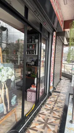
  5. Moveka Station

    Kwanza kids kamakis

    269 m from the route · send or collect parcels here

    1.3 km
  6. Kwa Roy

    2.4 km

    Change here for 145B

  7. Kamakis

    3.3 km
  8. Engen

    3.7 km

    Change here for 145B

  9. Mitikenda

    4.4 km
  10. Corner

    4.7 km

    Change here for 145B

  11. Mwiki

    9.4 km–11.0 km · 3 stages

    Nearest served area: Utawala

  12. 4.8 km to the next stage
  13. Kobe

    9.4 km

    Change here for 145B

  14. Centy Club

    10.3 km

    Change here for 145B

  15. St. Joseph

    11.0 km
  16. Ruai

    13.7 km–15.1 km · 3 stages

    Nearest served area: Utawala

  17. 2.7 km to the next stage
  18. Bypass

    13.7 km

    Change here for 33H38/39145B3738

  19. Onyata

    14.2 km
  20. Triple-0

    15.1 km

    Change here for 33H

  21. Njiru

    15.8 km · 1 stage

    Nearest served area: Utawala

  22. Fancy

    15.8 km

    Change here for 33H

  23. Embakasi

    16.1 km–16.8 km · 5 stages

    Nearest served area: Utawala

  24. Utawala Junction/ Benedicta

    16.1 km

    Change here for 33H33J33UTW

  25. Moveka Station

    Lucky threads

    218 m from the route · send or collect parcels here

    16.1 km
  26. Tumaini

    16.4 km

    Change here for 33H33J33UTW

  27. Family Bank

    16.5 km

    Change here for 33H33J33UTW

  28. Amani

    16.6 km

    Change here for 33H33J33UTW

  29. Shell

    16.8 km

    Change here for 33H

  30. Njiru

    17.1 km–18.7 km · 6 stages

    Nearest served area: Utawala

  31. Kwa Chief

    17.1 km

    Change here for 33H33J33UTW

  32. AP

    17.6 km

    Change here for 33H33J33UTW

  33. Keza

    17.7 km

    Change here for 33H33J33UTW

  34. Mihango Kayole Junction

    18.1 km

    Change here for 33H33J33UTW

  35. Moveka Station

    Streamlink Entertainment (Movie Shop)

    61 m from the route · send or collect parcels here

    18.1 km
  36. GSU

    18.5 km

    Change here for 33H33J33UTW

  37. Astro

    18.7 km

    Change here for 33H33J33UTW

  38. Embakasi

    19.3 km–24.6 km · 7 stages

    Nearest served area: Nyayo Estate Gate B

  39. China

    19.3 km

    Change here for 33H33J33UTW

  40. 2.9 km to the next stage
  41. Barraks/75

    22.2 km

    Change here for 33H33J33UTW

  42. Barracks/75 Rounda

    22.6 km

    Change here for 33B33FED33H33J

    and 1 more33UTW

  43. Airbase

    22.8 km

    Change here for 33H33UTW

  44. Kemsa Depot

    23.0 km
  45. Tuskys

    23.3 km

    Change here for 33B33FED33H33J

    and 1 more33UTW

  46. Aviation

    24.6 km

    Change here for 33J33UTW

  47. Pipeline

    26.3 km–26.9 km · 2 stages

    Nearest served area: Fedha

  48. 1.7 km to the next stage
  49. Taj Mall Roundabout

    26.3 km

    Change here for 33DC33H33J33UTW

    and 1 more34J

  50. Transami

    26.9 km

    Change here for 33B33DC33FED33H

    and 3 more33TP33UTW34J

  51. End
    Transami
    26.9 km

Ready to send?

Parcels travel route 39 too. Send from a Station on the line.

Send a package

Stops from Approved SACCOs - University of Nairobi C4D Lab reporting/sharing, service 2019 to 2020. Map data © OpenStreetMap contributors.